
Monitoring deer – the what, the where and the how (many). Australia doesn’t have a lot of data on deer. Until now we haven’t really needed it. Deer numbers were small. They posed no threat to primary producers, no threat to the environment and the native animals who live there, no threat on our roads. But in the last few years this has changed. Their numbers have increased exponentially and now we are beginning to see just how destructive they can be. So now the scientific community are playing catchup: how many deer are there? What species are there and where are they? How do they move and behave in the Australian landscape? What do they eat, what weeds do they distribute, what effect are they having on our waterways and peatlands, what diseases do they carry, and pass on, … there is a long list of unknowns, few knowns. Government agency and environment groups are becoming increasingly active in their efforts to gain some of this data. Below is a precis of some of the more common methods being used: Animal surveys: Camera-trap surveys Camera traps are motion and/or infrared sensitive cameras which are strategically placed and left in situ to take images of animal movement in their vicinity. They are usually left in place for periods of weeks, after which their images are downloaded and visually assessed for species types, numbers and locations. Camera-trap surveys will usually be trying to ascertain one of three types of information: Relative abundance
Occupancy
Density
Advantages
Disadvantages
Future
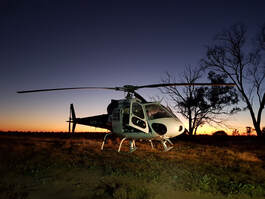
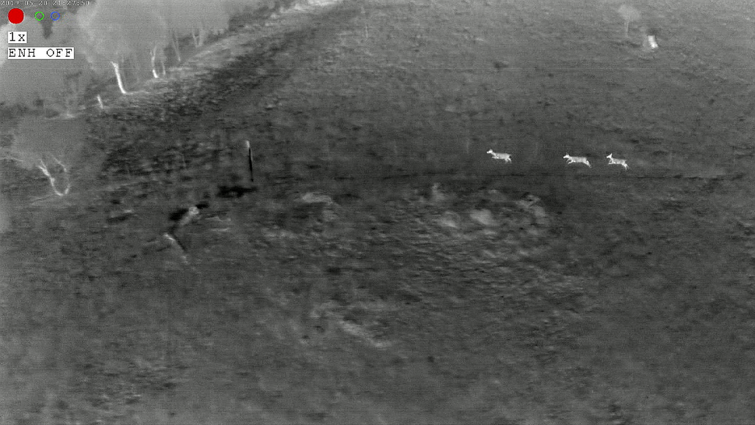
Aerial surveys Aerial surveys are done either by helicopter or drone. Helicopter surveys can be either manned (ie. visual only), use infrared cameras or both infrared & visual; drone surveys use infrared cameras only. Drones can be either the vertical or horizontal launch types. Surveys are normally done at dawn or dusk when the deer are more active and come out of the bush. This also allows better differentiation between the heat signature of the animals and the cooler background. Sometimes this is not possible in more populated areas due to concerns of disturbance, and surveys may need to be extended into the mornings and afternoons. The data gathered is then assessed and mapped to give an indication of the location and density of the deer population. This is increasingly being aided by species recognition software. Aerial surveys are becoming increasingly popular as their costs decrease and the technology improves. Advantages Helicopter over drone:
Drone over a helicopter:
In general, aerial surveys are of greatest benefit over large areas, with large numbers of animals and with open vegetation. Disadvantages
Future
Direct visual surveys Just what it says – simply people observing deer in their own surrounds, logging the data, including date, time & location and other observations. It can be with or without binoculars or, if after dark, with a thermal imaging scope. With proper scientific input, this data can be quite valuable. Not all surveys require advanced technology nor large amounts of expertise. This makes visual surveys a good mechanism for engaging the community. The DeerScan app is an example of a direct survey technique, where members of the community can use the app to record sightings of deer. These records can include other signs of deer as well, including finding deer scat, wallows, tree rubbings or even hearing deer. CDMC are registered as a Group within DeerScan. For more information on DeerScan and how you might be able to help us monitor deer, read the article on DeerScan under Get Involved on our website. Some other methods of recording animal sightings, including deer, is the Atlas of Living Australia or iNaturalist, which are available free to all. Radio trackingWhat are theyThis requires the placing of a radio tracking device on each animal. The device emits a signal which can then be used to locate the animal. Some of these need to be tracked using a hand held aerial, whereas others can be picked up and located by satellite. Advantages
Disadvantages
Radio tracking would be a wonderful tool to add to the deer knowledge base, as there is scarce information about the behaviour of deer in our landscape. Understanding this would be a wonderful help in planning for better techniques in controlling deer. Unfortunately it is extremely expensive and due to animal ethics reasons are usually conducted by a university or other scientific organisation. Faecal pellet surveys Not the most romantic of surveys, but highly effective. In this technique, regular counts of faecal pellets are conducted at nominated sites over a regular timeframe. This is then compared over time to see if the counts decrease or increase. Advantages
Disadvantages
Note: The use of DNA analysis of faecal samples can also be very valuable in identifying species, population sizes (variation found between samples) and the origins and movement of deer over time. It is not commonly done due to expense and the expertise required. Vegetation surveys There are three major categories of these:
Advantages
Disadvantages
Other There are several other areas of measuring deer impact, such as loss of farm income, monitoring costs of deer mitigation, costs of deer vehicle collisions. Too many to cover in this article. If you have further information in this area, or questions relating to any of the above, we would love to hear from you. Please email us at [email protected]
0 Comments
Your comment will be posted after it is approved.
Leave a Reply. |
 RSS Feed
